Anti-stigma training programme supports public health professionals
A new training course designed to support health and social professionals working with people…


A new training course designed to support health and social professionals working with people…

Universities for North East England (UNEE) welcomes the new English Devolution and Community…

A researcher at Northumbria University is part of a collaboration to create three new ‘Green…
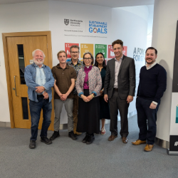
Northumbria University’s Newcastle Business School recently welcomed Bishop of Newcastle The…
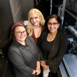
Scientists at Northumbria University have made a breakthrough in developing a new type of ‘microwave…

Northumbria University is to provide its students and staff with access to Claude for Education…
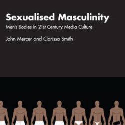
In a media world saturated with gym selfies, reality TV abs, and influencer thirst traps, a…
A pioneering partnership between Northumbria University and award-winning community charity…

Student Central (Library Building), Ground floor foyer
Northumbria University Business and Law School (CCE1)
-

Virtual Event
-
Back to top